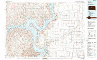
1986 Map of Onida
USGS Topo · Published 1989About this map
Lake Oahe dominates this central South Dakota landscape, where the waters of the Missouri River meet the Cheyenne River. The western portion of the sheet is defined by the Cheyenne River Indian Reservation Boundary, while the eastern plains are characterized by a grid-like organization of agricultural land and small rail-centered settlements. The Chicago and North Western railroad provides a vital lifeline to the town of Onida, the regional hub, and nearby Agar. Away from the water, the terrain includes distinctive landmarks such as Mission Ridge and Medicine Butte. Multiple recreation and game production sites, including the Sutton State Game Production Area and Okobojo Creek Recreation Area, line the irregular shores of the lake, illustrating the 1980s-era emphasis on public land management and water-based geography.
Find a feature on this map
38 named features on this map. Tap any name to fly to it.
Don’t see what you’re looking for? This feature index may not catch every label — zoom into the map to look around manually.
Map Details
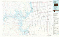
Editions of this 1986 Onida Map
2 editions found
Other maps of this area

1924 · Pierre
USGS Topo · 1:62,500

1934 · Canning
USGS Topo · 1:48,000

1937 · Canning
USGS Topo · 1:62,500

1937 · Oahe
USGS Topo · 1:62,500

1953 · Huron
USGS Topo · 1:250,000

1953 · McIntosh
USGS Topo · 1:250,000

1954 · Aberdeen
USGS Topo · 1:250,000

1954 · Pierre
USGS Topo · 1:250,000

1954 · Huron
USGS Topo · 1:250,000

1956 · Aberdeen
USGS Topo · 1:250,000