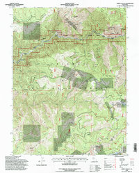
1994 Map of Onion Valley
USGS Topo · Published 1998About this map
The Middle Fork Feather Wild and Scenic River carves through this portion of the Plumas National Forest, a landscape defined by its long history of resource extraction. Multiple river bars, including Oddie Bar, Ranger Bar, and McCarthy Bar, mark the waterway's course, signaling the region's enduring connection to early mining efforts. High-altitude mining operations are scattered across the terrain, with specific sites such as the White Pine Chrome Mine, Egbert Mine, and Feather Fork Mine indicating the variety of minerals sought in the northern Sierra Nevada.
Find a feature on this map
63 named features on this map. Tap any name to fly to it.
Don’t see what you’re looking for? This feature index may not catch every label — zoom into the map to look around manually.
Map Details
Editions of this 1994 Onion Valley Map
This is the sole edition of this map. No revisions or reprints were ever made.
Other maps of this area

1888 · Bidwell Bar
USGS Topo · 1:125,000

1891 · Bidwell Bar
USGS Topo · 1:125,000

1891 · Downieville
USGS Topo · 1:125,000

1893 · Bidwell Bar
USGS Topo · 1:125,000

1893 · Downieville
USGS Topo · 1:125,000

1895 · Bidwell Bar
USGS Topo · 1:125,000

1895 · Downieville
USGS Topo · 1:125,000

1896 · Downieville
USGS Topo · 1:125,000

1897 · Bidwell Bar
USGS Topo · 1:125,000

1897 · Downieville
USGS Topo · 1:125,000