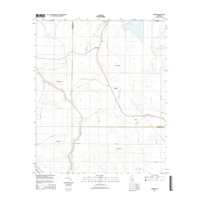
2015 Map of Onward
USGS Topo · Published 2015About this map
Onward, Smedes, and Kelso anchor this landscape along the border of Sharkey and Issaquena counties. The area is defined by a dense network of meandering waterways, including Steele Bayou, Deer Creek, and Little Black Bayou, which dictate the placement of local roads and small settlements. The terrain reflects the alluvial nature of the Mississippi Delta, where historical watercourses like False River and Coon Bayou have left a complex pattern of oxbows and marshy lowlands. Local infrastructure is closely tied to these natural features, with routes such as Black Bayou Rd and Goose Lake Rd tracing the high ground between wetlands. The map provides a detailed view of the rural settlement patterns and drainage systems in this region of the Deep South during the mid-2010s.
Find a feature on this map
37 named features on this map. Tap any name to fly to it.
Don’t see what you’re looking for? This feature index may not catch every label — zoom into the map to look around manually.
Map Details
Editions of this 2015 Onward Map
This is the sole edition of this map. No revisions or reprints were ever made.
Other maps of this area

1939 · Onward
USGS Topo · 1:62,500

1939 · Lorenzen
USGS Topo · 1:62,500

1939 · Alsatia
USGS Topo · 1:62,500

1939 · Mayersville
USGS Topo · 1:62,500

1955 · Jackson
USGS Topo · 1:250,000

1961 · Jackson
USGS Topo · 1:250,000

1962 · Jackson
USGS Topo · 1:250,000

1963 · Onward
USGS Topo · 1:62,500

1964 · Lorenzen
USGS Topo · 1:62,500
1970 · Whiting Bayou
USGS Topo · 1:24,000