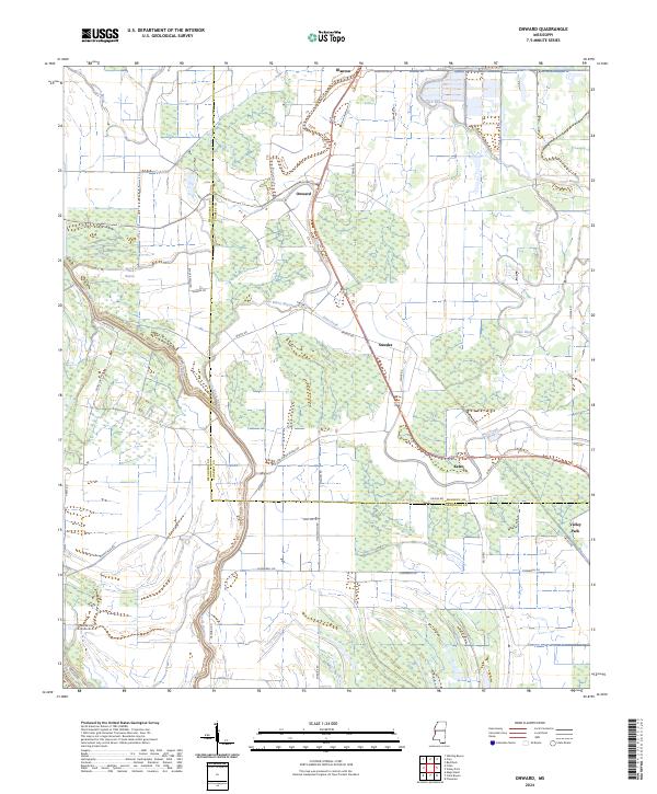
2024 Map of Onward
USGS Topo · Published 2024About this map
Theodore Roosevelt National Wildlife Refuge dominates the landscape of the lower Mississippi Delta, preserving the complex wetland ecosystems of Issaquena and Sharkey counties. The area is defined by a dense network of meandering waterways, including the prominent Deer Creek, Steele Bayou, and Black Bayou, which reflect the region's alluvial history. Small, dispersed settlements like Onward, Smedes, and Kelso are connected by a grid of rural roads such as Low Water Bridge Rd and Black Bayou Rd, tracing the higher ground between the bayous.
Find a feature on this map
40 named features on this map. Tap any name to fly to it.
Don’t see what you’re looking for? This feature index may not catch every label — zoom into the map to look around manually.
Map Details
Editions of this 2024 Onward Map
This is the sole edition of this map. No revisions or reprints were ever made.
Other maps of this area

1939 · Onward
USGS Topo · 1:62,500

1939 · Lorenzen
USGS Topo · 1:62,500

1939 · Alsatia
USGS Topo · 1:62,500

1939 · Mayersville
USGS Topo · 1:62,500

1955 · Jackson
USGS Topo · 1:250,000

1961 · Jackson
USGS Topo · 1:250,000

1962 · Jackson
USGS Topo · 1:250,000

1963 · Onward
USGS Topo · 1:62,500

1964 · Lorenzen
USGS Topo · 1:62,500
1970 · Whiting Bayou
USGS Topo · 1:24,000