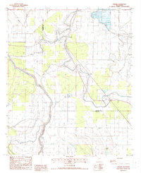
1988 Map of Onward
USGS Topo · Published 1988About this map
Deer Creek meanders sharply through the heart of the Mississippi Delta in this 1980s topographic record of Issaquena and Sharkey counties. The landscape is defined by its complex hydrology, where the meandering paths of Steele Bayou and Black Bayou trace the flat alluvial terrain between the small settlements of Onward and Smedes. This period captures the region as it balanced long-standing agricultural patterns with newer developments like the Fish Farm near Coon Bayou. The presence of an Old RR Grade south of Kelso marks the path of former rail lines that once served these rural communities, providing a vital link for genealogists tracing the movement of families and goods across the delta's fertile reaches. From Blanton in the north to Cypress Lake in the south, the map details a world of drainage canals and bayous essential to life in the flood-prone Mississippi basin.
Find a feature on this map
17 named features on this map. Tap any name to fly to it.
Don’t see what you’re looking for? This feature index may not catch every label — zoom into the map to look around manually.
Map Details
Editions of this 1988 Onward Map
This is the sole edition of this map. No revisions or reprints were ever made.
Other maps of this area

1939 · Onward
USGS Topo · 1:62,500

1939 · Lorenzen
USGS Topo · 1:62,500

1939 · Alsatia
USGS Topo · 1:62,500

1939 · Mayersville
USGS Topo · 1:62,500

1955 · Jackson
USGS Topo · 1:250,000

1961 · Jackson
USGS Topo · 1:250,000

1962 · Jackson
USGS Topo · 1:250,000

1963 · Onward
USGS Topo · 1:62,500

1964 · Lorenzen
USGS Topo · 1:62,500
1970 · Whiting Bayou
USGS Topo · 1:24,000