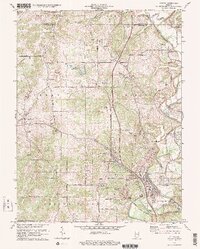
1978 Map of Oolitic
USGS Topo · Published 1978About this map
Oolitic and East Oolitic serve as the industrial anchors for this southern Indiana landscape, dominated by the limestone quarrying operations that gave the area its name. The map reveals a high concentration of extraction sites, including the Pacific Quarry and various unnamed Quarry pits concentrated near the rail corridors. Transportation is defined by the Louisville and Nashville and Chicago Milwaukee St Paul and Pacific railroads, which weave through the valleys of Salt Creek and Goose Creek. Educational and civic life is anchored by the Oolitic School and Springville School, while rural heritage is preserved at the Avoca State Fish Hatchery and the Purdue University Experimental Farm. From the small settlements of Needmore and Peerless to the edges of the Hoosier National Forest, the map captures a period where traditional limestone industry and agricultural research coexisted.
Find a feature on this map
75 named features on this map. Tap any name to fly to it.
Don’t see what you’re looking for? This feature index may not catch every label — zoom into the map to look around manually.
Map Details
Editions of this 1978 Oolitic Map
3 editions found
Other maps of this area

1908 · Bloomington
USGS Topo · 1:48,000

1910 · Bloomington
USGS Topo · 1:62,500

1934 · Bedford
USGS Topo · 1:48,000

1935 · Oolitic
USGS Topo · 1:48,000

1937 · Bedford
USGS Topo · 1:62,500

1942 · Franklin
USGS Topo · 1:125,000

1942 · Oolitic
USGS Topo · 1:62,500

1947 · Allens Creek
USGS Topo · 1:24,000

1953 · Indianapolis
USGS Topo · 1:250,000

1956 · Indianapolis
USGS Topo · 1:250,000