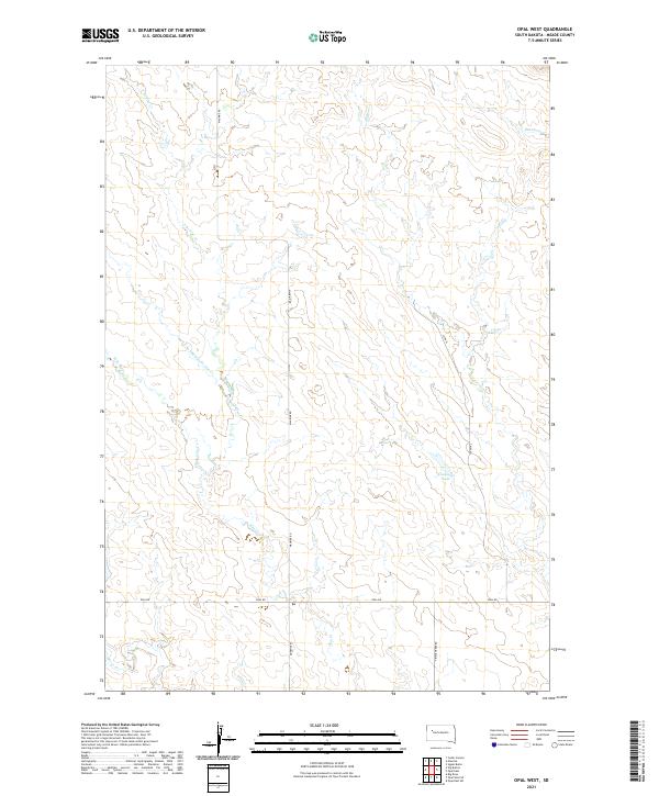
2021 Map of Opal West
USGS Topo · Published 2021About this map
Vansickel Lake serves as a central landmark in this portion of Meade County, where the landscape is defined by the complex branching of the Pine Creek system. The hydrography of the region is traced through the E Br Pine Cr, Middle Br Pine Cr, and W Br Pine Cr, which converge as they flow through the northern reaches of the quadrangle. This 2021 survey reflects the modern rural infrastructure of South Dakota, where long-established section lines and township boundaries like t12n r12e and t11n r13e dictate the path of local travel. Transportation is primarily facilitated by a network of rural routes including Maurine Rd and Opal Rd, which connect remote ranchlands and drainages such as Beaver Cr and Horse Cr to the wider county seat and surrounding agricultural communities.
Find a feature on this map
16 named features on this map. Tap any name to fly to it.
Don’t see what you’re looking for? This feature index may not catch every label — zoom into the map to look around manually.
Map Details
Editions of this 2021 Opal West Map
This is the sole edition of this map. No revisions or reprints were ever made.
Other maps of this area

1951 · Cedar Canyon
USGS Topo · 1:24,000

1951 · Maurine
USGS Topo · 1:24,000

1952 · Signal Butte
USGS Topo · 1:24,000

1953 · Rapid City
USGS Topo · 1:250,000

1954 · Lemmon
USGS Topo · 1:250,000

1957 · Lemmon
USGS Topo · 1:250,000

1957 · Rapid City
USGS Topo · 1:250,000

1983 · Opal West SE
USGS Topo · 1:24,000
1983 · Squaw Buttes
USGS Topo · 1:24,000
1983 · Opal East
USGS Topo · 1:24,000