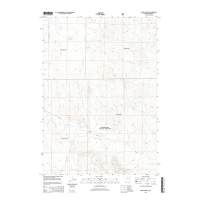
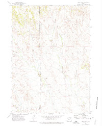
2015 Map of Open A Ranch
USGS Topo · Published 2015About this map
Thunder Basin National Grassland dominates the southern half of this landscape, where the high plains are carved by the intermittent drainage of Black Thunder Cr. Centered around the eponymous Open A Ranch, the area reveals a pattern of modern water management essential for high-desert ranching, featuring several family-named catchments such as Spath Reservoir, Smith Reservoir, and The Robb Reservoir. The geography is defined by a series of long, parallel drainage systems including Cottonwood Cr and Bacon Cr, which flow northward across the township lines. Transportation across this corner of Campbell County relies on primitive routes like Keeline Rd and Lawver Rd, which provide access to the remote pastures and isolated homesteads that characterize this section of the Wyoming range.
Find a feature on this map
20 named features on this map. Tap any name to fly to it.
Don’t see what you’re looking for? This feature index may not catch every label — zoom into the map to look around manually.
Map Details
Editions of this 2015 Open A Ranch Map
This is the sole edition of this map. No revisions or reprints were ever made.
Other maps of this area

1955 · Newcastle
USGS Topo · 1:250,000

1958 · Newcastle
USGS Topo · 1:250,000
1971 · Piney Canyon NE
USGS Topo · 1:24,000
1971 · Open A Ranch
USGS Topo · 1:24,000
1971 · Rough Creek
USGS Topo · 1:24,000
1971 · Reno Reservoir
USGS Topo · 1:24,000
1971 · Piney Canyon NW
USGS Topo · 1:24,000
1971 · Jim Creek
USGS Topo · 1:24,000
1971 · Hilight
USGS Topo · 1:24,000
1971 · Buck Creek
USGS Topo · 1:24,000