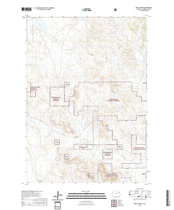
2021 Map of Open A Ranch
USGS Topo · Published 2021About this map
Open A Ranch sits at the heart of this high plains landscape in Campbell County, where the topography is defined by the complex drainage systems of the Powder River Basin. The map illustrates a transitional ranching environment largely encompassed by the Thunder Basin National Grassland. Water management is central to the area's utility, evidenced by a series of named catchments including Spath Reservoir, Smith Reservoir, and The Robb Reservoir, which support livestock in an otherwise arid expanse. The terrain is deeply etched by numerous seasonal waterways such as Black Thunder Creek and Cottonwood Creek. Transportation through these grasslands relies on a sparse network of established routes like Keeline Rd and Lawyer Rd, which connect the remote ranching outposts to the wider region. This survey provides a modern view of the land use patterns and grazing boundaries that continue to shape northeastern Wyoming.
Find a feature on this map
22 named features on this map. Tap any name to fly to it.
Don’t see what you’re looking for? This feature index may not catch every label — zoom into the map to look around manually.
Map Details
Editions of this 2021 Open A Ranch Map
This is the sole edition of this map. No revisions or reprints were ever made.
Other maps of this area

1955 · Newcastle
USGS Topo · 1:250,000

1958 · Newcastle
USGS Topo · 1:250,000

1971 · Piney Canyon NE
USGS Topo · 1:24,000

1971 · Open A Ranch
USGS Topo · 1:24,000

1971 · Rough Creek
USGS Topo · 1:24,000

1971 · Reno Reservoir
USGS Topo · 1:24,000

1971 · Piney Canyon NW
USGS Topo · 1:24,000
1971 · Jim Creek
USGS Topo · 1:24,000
1971 · Hilight
USGS Topo · 1:24,000
1971 · Buck Creek
USGS Topo · 1:24,000