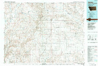
1984 Map of Opheim
USGS Topo · Published 1984About this map
Opheim Air Force Station stands as a prominent Cold War landmark in this northeastern Montana landscape, situated just south of the Opheim Port of Entry along the Canada-United States border. The settlement of Opheim serves as the local hub, connected to outlying communities like Glentana, Richland, and Larslan by a network of roads and the Burlington Northern railroad. The terrain is defined by the Opheim Hills and a series of coulees, including Snow Coulee and Dolson Coulee, which drain toward the Poplar River.
Find a feature on this map
57 named features on this map. Tap any name to fly to it.
Don’t see what you’re looking for? This feature index may not catch every label — zoom into the map to look around manually.
Map Details
Editions of this 1984 Opheim Map
This is the sole edition of this map. No revisions or reprints were ever made.
Other maps of this area
1906 · Hinsdale Special Map
USGS Topo · 1:62,500
1910 · Todd Lakes
USGS Topo · 1:62,500
1915 · Todd Lakes
USGS Topo · 1:62,500
1915 · Spring Creek
USGS Topo · 1:62,500
1918 · Porcupine Valley
USGS Topo · 1:62,500
1919 · Boundary
USGS Topo · 1:125,000
1943 · Glasgow
USGS Topo · 1:125,000
1954 · Wolf Point
USGS Topo · 1:250,000
1954 · Glasgow
USGS Topo · 1:250,000
1957 · Glasgow
USGS Topo · 1:250,000