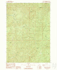
1989 Map of Ophir Mountain
USGS Topo · Published 1989About this map
Siskiyou National Forest dominates this 1980s landscape at the boundary of Coos and Curry Counties, characterized by the steep drainage basins of the Elk River and Boulder Creek. The map documents a rugged timber and mining wilderness where peaks like Iron Mountain and Ophir Mountain overlook deep interior valleys. This era shows the infrastructure of forest management and early recreation, with established sites such as Laird Lake Campground and remote outposts like Toast Camp and McCurdy Camp.
Find a feature on this map
32 named features on this map. Tap any name to fly to it.
Don’t see what you’re looking for? This feature index may not catch every label — zoom into the map to look around manually.
Map Details
Editions of this 1989 Ophir Mountain Map
This is the sole edition of this map. No revisions or reprints were ever made.
Other maps of this area

1899 · Port Orford
USGS Topo · 1:125,000

1903 · Port Orford
USGS Topo · 1:125,000

1954 · Coos Bay
USGS Topo · 1:250,000

1954 · Port Orford
USGS Topo · 1:62,500

1954 · Agness
USGS Topo · 1:62,500

1954 · Powers
USGS Topo · 1:62,500

1954 · Langlois
USGS Topo · 1:62,500

1958 · Coos Bay
USGS Topo · 1:250,000

1962 · Coos Bay
USGS Topo · 1:250,000
1986 · Father Mountain
USGS Topo · 1:24,000