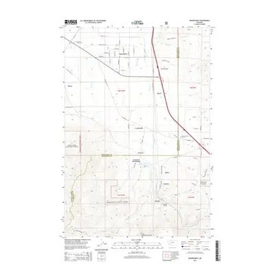
2014 Map of Opportunity
USGS Topo · Published 2014About this map
Fairmont Hot Springs and the surrounding high-country terrain of Deerlodge National Forest anchor this 2014 survey of the Silver Bow valley. The landscape is defined by the intersection of industrial transport and natural drainage, where the Silver Bow Creek and the MT-1 rail line navigate between the rugged elevations of German Gulch and Hensley Gulch. Smaller settlements and sidings like Crackerville, Gregson, and Finlen are situated along the valley floor, reflecting the historic development patterns of the Montana mining and ranching corridor. In the northern reaches, the map details the residential layout of Opportunity and the Anaconda Catholic Cemetery, while the western edge is marked by irrigation infrastructure like the Yellow Ditch. The presence of several springs, including Wire Spring and the unusually named 02N10W02BDAC01 Spring, indicates the complex hydrology supporting the communities tucked between these mountain ranges.
Find a feature on this map
69 named features on this map. Tap any name to fly to it.
Don’t see what you’re looking for? This feature index may not catch every label — zoom into the map to look around manually.
Map Details
Editions of this 2014 Opportunity Map
This is the sole edition of this map. No revisions or reprints were ever made.
Other maps of this area

1889 · Helena
USGS Topo · 1:250,000

1893 · Helena
USGS Topo · 1:250,000

1893 · Dillon
USGS Topo · 1:250,000

1899 · Helena
USGS Topo · 1:250,000

1903 · Helena
USGS Topo · 1:250,000

1947 · Butte
USGS Topo · 1:250,000

1955 · Dillon
USGS Topo · 1:250,000

1957 · Dillon
USGS Topo · 1:250,000

1958 · Butte
USGS Topo · 1:250,000

1958 · Dillon
USGS Topo · 1:250,000