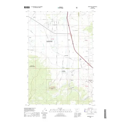
2020 Map of Opportunity
USGS Topo · Published 2020About this map
Silver Bow Cr flows through a landscape defined by industrial history and natural thermal features near the boundary of Anaconda-Deer Lodge County and Silver Bow County. The community of Opportunity serves as a focal point in the north, while the southern terrain transitions into the steep slopes of the Deerlodge National Forest. This 2020 map documents the modern footprint of Fairmont Hot Springs, a long-standing regional landmark, alongside the established settlements of Gregson and Crackerville.
Find a feature on this map
71 named features on this map. Tap any name to fly to it.
Don’t see what you’re looking for? This feature index may not catch every label — zoom into the map to look around manually.
Map Details
Editions of this 2020 Opportunity Map
This is the sole edition of this map. No revisions or reprints were ever made.
Other maps of this area

1889 · Helena
USGS Topo · 1:250,000

1893 · Helena
USGS Topo · 1:250,000

1893 · Dillon
USGS Topo · 1:250,000

1899 · Helena
USGS Topo · 1:250,000

1903 · Helena
USGS Topo · 1:250,000

1947 · Butte
USGS Topo · 1:250,000

1955 · Dillon
USGS Topo · 1:250,000

1957 · Dillon
USGS Topo · 1:250,000

1958 · Butte
USGS Topo · 1:250,000

1958 · Dillon
USGS Topo · 1:250,000