1996 Map of Opportunity
USGS Topo · Published 1998About this map
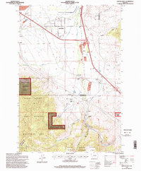
Silver Bow Creek and Mill Creek flow through this section of the Montana landscape, framing the communities of Opportunity and Crackerville during the mid-1990s. The geography is defined by a transition from the industrial legacy of Gravel Pit sites and Tailings near the northern boundary to the protected elevations of the Deerlodge National Forest. To the south, the terrain rises toward the massive Mount Haggin, within the State Wildlife Management Area, and Fleecer Mountain Wildlife Management Area. Local recreation and community landmarks are prominent, including the Fairmont Hot Springs Resort, multiple golf courses, and the Sunset Memorial Gardens Cemetery. Small settlements and historical sites like Gregson, Staton, and the Hackney (Site) are captured along the corridors of the Silver Bow Co and Deer Lodge Co boundary, offering a detailed view of the regional transport and settlement patterns.
Find a feature on this map
33 named features on this map. Tap any name to fly to it.
Don’t see what you’re looking for? This feature index may not catch every label — zoom into the map to look around manually.
Map Details
Editions of this 1996 Opportunity Map
This is the sole edition of this map. No revisions or reprints were ever made.
Other maps of this area

1889 · Helena
USGS Topo · 1:250,000

1893 · Helena
USGS Topo · 1:250,000

1893 · Dillon
USGS Topo · 1:250,000

1899 · Helena
USGS Topo · 1:250,000

1903 · Helena
USGS Topo · 1:250,000

1947 · Butte
USGS Topo · 1:250,000

1955 · Dillon
USGS Topo · 1:250,000

1957 · Dillon
USGS Topo · 1:250,000

1958 · Butte
USGS Topo · 1:250,000

1958 · Dillon
USGS Topo · 1:250,000