
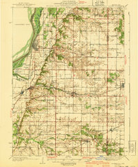
1940 Map of Oquawka
USGS Topo · Published 1940About this map
Oquawka serves as a critical riverfront hub on this pre-war survey, where the Mississippi River meets a complex network of sloughs and islands like Benton Island. The landscape transitions from the river bottoms to the dissected uplands of Henderson County, marked by a dense distribution of rural institutions. Local history and genealogy interest is particularly high here due to the numerous family-named and community landmarks, including the County Farm and a vast array of country schools such as the Little Brick Sch, Twentieth Century Sch, and Hazel Dell Sch.
Find a feature on this map
80 named features on this map. Tap any name to fly to it.
Don’t see what you’re looking for? This feature index may not catch every label — zoom into the map to look around manually.
Map Details
Editions of this 1940 Oquawka Map
2 editions found
Other maps of this area

1916 · Good Hope
USGS Topo · 1:62,500

1918 · La Harpe
USGS Topo · 1:62,500

1918 · Good Hope
USGS Topo · 1:62,500

1921 · Monmouth
USGS Topo · 1:62,500

1923 · Monmouth
USGS Topo · 1:62,500

1923 · Alexis
USGS Topo · 1:62,500

1925 · Alexis
USGS Topo · 1:62,500

1932 · Lomax
USGS Topo · 1:62,500

1934 · Oquawka
USGS Topo · 1:48,000

1934 · Burlington
USGS Topo · 1:48,000