
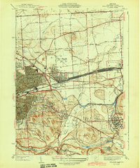
1942 Map of Oran
USGS Topo · Published 1957About this map
Limestone Creek and its many tributaries carve a series of dramatic ravines and waterfalls across this landscape southeast of Syracuse. The topography is defined by significant features such as Edwards Falls, Brickyard Falls, and the notable Pratts Falls County Park, all appearing during a period of established rural infrastructure. The map illustrates a dense network of local education, marking numerous one-room schoolhouses such as School No 14 and School No 10, along with the prominent Manlius Sch in the north. The cultural landscape is anchored by the Indian Hill Memorial and scattered family or community burial grounds including Southwell Cem and Pease Cem. Transport is dominated by the N Y C railroad line skirting Cazenovia Lake and the historic Cherry Valley Turnpike cutting east-west through the hills, connecting small crossroads like Pompey Center and Oran.
Find a feature on this map
52 named features on this map. Tap any name to fly to it.
Don’t see what you’re looking for? This feature index may not catch every label — zoom into the map to look around manually.
Map Details
Editions of this 1942 Oran Map
This is the sole edition of this map. No revisions or reprints were ever made.
Other maps of this area

1895 · Chittenango
USGS Topo · 1:62,500

1895 · Syracuse
USGS Topo · 1:62,500

1897 · Cazenovia
USGS Topo · 1:62,500

1898 · Syracuse
USGS Topo · 1:62,500

1898 · Chittenango
USGS Topo · 1:62,500

1899 · Cazenovia
USGS Topo · 1:62,500

1900 · Tully
USGS Topo · 1:62,500

1902 · Chittenango
USGS Topo · 1:62,500

1938 · Syracuse East
USGS Topo · 1:24,000
1943 · Syracuse East
USGS Topo · 1:31,680