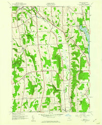
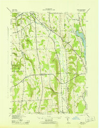
1943 Map of Oran
USGS Topo · Published 1960About this map
Limestone Creek carves a deep path through the heart of this landscape, its descent marked by dramatic features like Edwards Falls and Brickyard Falls near the village of Manlius. The 1940s terrain is defined by its agricultural and industrial heritage, with the New York Central railroad corridor facilitating transport through the valley. Upland areas are punctuated by small hamlets and distinct geographic cuts known as gulfs, including Hatch Gulf and Brown Gulf.
Find a feature on this map
44 named features on this map. Tap any name to fly to it.
Don’t see what you’re looking for? This feature index may not catch every label — zoom into the map to look around manually.
Map Details
Editions of this 1943 Oran Map
2 editions found
Other maps of this area

1895 · Chittenango
USGS Topo · 1:62,500

1895 · Syracuse
USGS Topo · 1:62,500

1897 · Cazenovia
USGS Topo · 1:62,500

1898 · Syracuse
USGS Topo · 1:62,500

1898 · Chittenango
USGS Topo · 1:62,500

1899 · Cazenovia
USGS Topo · 1:62,500

1900 · Tully
USGS Topo · 1:62,500

1902 · Chittenango
USGS Topo · 1:62,500

1938 · Syracuse East
USGS Topo · 1:24,000

1942 · Oran
USGS Topo · 1:24,000