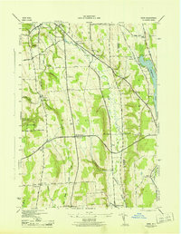
1943 Map of Oran
USGS Topo · Published 1943About this map
Limestone Creek and its various branches carve through the landscape of Onondaga County, shaping the settlement patterns of the mid-20th century. This survey, mapped by the Tennessee Valley Authority for the War Department, reveals a rural network of small hamlets such as Oran and Watervale, each anchored by essential community structures like School No 14 and School No 12. The presence of the NYC railroad and the Cherry Valley Turnpike underscores the area's role as a transportation corridor connecting Manlius to the eastern shores of Cazenovia Lake.
Find a feature on this map
64 named features on this map. Tap any name to fly to it.
Don’t see what you’re looking for? This feature index may not catch every label — zoom into the map to look around manually.
Map Details
Editions of this 1943 Oran Map
2 editions found
Other maps of this area

1895 · Chittenango
USGS Topo · 1:62,500

1895 · Syracuse
USGS Topo · 1:62,500

1897 · Cazenovia
USGS Topo · 1:62,500

1898 · Syracuse
USGS Topo · 1:62,500

1898 · Chittenango
USGS Topo · 1:62,500

1899 · Cazenovia
USGS Topo · 1:62,500

1900 · Tully
USGS Topo · 1:62,500

1902 · Chittenango
USGS Topo · 1:62,500

1938 · Syracuse East
USGS Topo · 1:24,000

1942 · Oran
USGS Topo · 1:24,000