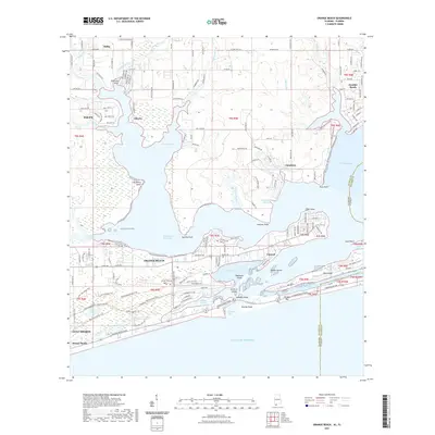
2021 Map of Orange Beach
USGS Topo · Published 2021About this map
Orange Beach and Gulf Shores anchor this coastal survey, where the development of the Alabama shoreline meets the complex waterways of the Gulf. The Intracoastal Waterway cuts through the landscape, separating the mainland from the barrier islands and connecting Hammock Bay to the larger Perdido Bay. This network of lagoons and inlets includes Cotton Bayou, Terry Cove, and the prominent Perdido Pass, which serves as a critical maritime gateway.
Find a feature on this map
72 named features on this map. Tap any name to fly to it.
Don’t see what you’re looking for? This feature index may not catch every label — zoom into the map to look around manually.
Map Details
Editions of this 2021 Orange Beach Map
This is the sole edition of this map. No revisions or reprints were ever made.
Other maps of this area

1921 · Bon Secour
USGS Topo · 1:62,500

1921 · Fort Barrancas
USGS Topo · 1:62,500

1941 · Fort Barrancas
USGS Topo · 1:62,500

1941 · Foley
USGS Topo · 1:62,500

1943 · Fort Barrancas
USGS Topo · 1:62,500

1943 · Foley
USGS Topo · 1:62,500

1944 · Perdido Bay North
USGS Topo · 1:25,000

1944 · Miflin
USGS Topo · 1:25,000

1944 · Perdido Bay South
USGS Topo · 1:25,000

1957 · Pensacola
USGS Topo · 1:250,000