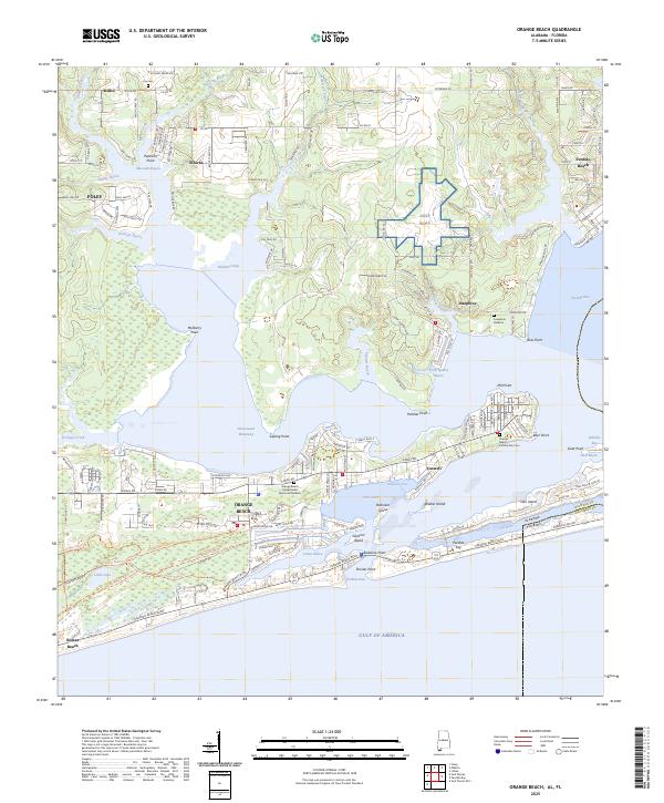
2025 Map of Orange Beach
USGS Topo · Published 2025About this map
Orange Beach and its surrounding coastal inlets define this landscape where the Intracoastal Waterway cuts through the Alabama shoreline. The map reveals a complex network of bayous and points, from Peterson Point near Miflin to Bear Point at the eastern tip of the peninsula. Highlighting the area's strategic and recreational importance, the military presence of Nolf Wolf sits inland, while the coastline is dotted with residential development and landmarks like Alabama Point. Genealogists and local historians can locate the Orange Beach Community Cemetery and Lay Cemetery, alongside the Orange Beach Presbyterian Memorial Gardens. The geography is shaped by water, including Hammock Bay, Cotton Bayou, and the Old River which separates Ono Island from the mainland, all leading toward the critical navigation point at Perdido Pass.
Find a feature on this map
100 named features on this map. Tap any name to fly to it.
Don’t see what you’re looking for? This feature index may not catch every label — zoom into the map to look around manually.
Map Details
Editions of this 2025 Orange Beach Map
This is the sole edition of this map. No revisions or reprints were ever made.
Other maps of this area

1921 · Bon Secour
USGS Topo · 1:62,500

1921 · Fort Barrancas
USGS Topo · 1:62,500

1941 · Fort Barrancas
USGS Topo · 1:62,500

1941 · Foley
USGS Topo · 1:62,500

1943 · Fort Barrancas
USGS Topo · 1:62,500

1943 · Foley
USGS Topo · 1:62,500

1944 · Perdido Bay North
USGS Topo · 1:25,000

1944 · Miflin
USGS Topo · 1:25,000

1944 · Perdido Bay South
USGS Topo · 1:25,000

1957 · Pensacola
USGS Topo · 1:250,000