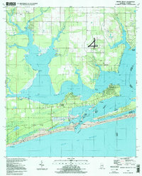
1994 Map of Orange Beach
USGS Topo · Published 1998About this map
Wolf Bay and Perdido Bay define this coastal landscape on the Alabama-Florida border during the mid-1990s. The map illustrates a complex network of bayous and inlets, including St John Bayou and Cotton Bayou, which intersect with the engineered path of the Intracoastal Waterway. The settlement patterns here reflect a transition from small, established communities like Miflin and Josephine to the expanding leisure and residential developments of Orange Beach and Ono. Notable landmarks of the era include the U S Naval Res Wolf Field and the extensive shoreline of Gulf State Park. The survey also documents local industry and infrastructure, from a Claypit near Miflin Creek to the various boat ramps and water tanks that supported this growing maritime region at the end of the 20th century.
Find a feature on this map
57 named features on this map. Tap any name to fly to it.
Don’t see what you’re looking for? This feature index may not catch every label — zoom into the map to look around manually.
Map Details
Editions of this 1994 Orange Beach Map
This is the sole edition of this map. No revisions or reprints were ever made.
Other maps of this area

1921 · Bon Secour
USGS Topo · 1:62,500

1921 · Fort Barrancas
USGS Topo · 1:62,500

1941 · Fort Barrancas
USGS Topo · 1:62,500

1941 · Foley
USGS Topo · 1:62,500

1943 · Fort Barrancas
USGS Topo · 1:62,500

1943 · Foley
USGS Topo · 1:62,500

1944 · Perdido Bay North
USGS Topo · 1:25,000

1944 · Miflin
USGS Topo · 1:25,000

1944 · Perdido Bay South
USGS Topo · 1:25,000

1957 · Pensacola
USGS Topo · 1:250,000