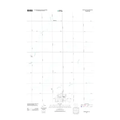
2013 Map of Orange City
USGS Topo · Published 2013About this map
Orange City serves as the focal point of this Sioux County survey, showcasing the town's grid and localized landmarks in the early 21st century. The map details the transition from the structured street plan of the city, which includes specific features like the Vogel Windmill, to the vast surrounding agricultural landscape. Notable rural sites such as the Sioux County Home and the Schelling Dairy are positioned within the extensive network of numbered section roads, including 400th St and 430th St. To the northwest, the settlement of Middleburg sits near the winding course of the W Br Floyd River. The geography is further defined by the drainage of the Orange City Slough, which meanders through the southern portions of the quadrangle. This layout reflects the enduring agrarian character of northwest Iowa, where small settlements and specialized facilities are linked by a precise, miles-long grid of gravel and paved roads.
Find a feature on this map
42 named features on this map. Tap any name to fly to it.
Don’t see what you’re looking for? This feature index may not catch every label — zoom into the map to look around manually.
Map Details
Editions of this 2013 Orange City Map
This is the sole edition of this map. No revisions or reprints were ever made.
Other maps of this area

1954 · Fairmont
USGS Topo · 1:250,000

1954 · Fort Dodge
USGS Topo · 1:250,000
1955 · Sioux City
USGS Topo · 1:250,000
1955 · Sioux Falls
USGS Topo · 1:250,000
1957 · Fort Dodge
USGS Topo · 1:250,000
1958 · Sioux City
USGS Topo · 1:250,000
1958 · Sioux Falls
USGS Topo · 1:250,000
1958 · Fort Dodge
USGS Topo · 1:250,000

1958 · Fairmont
USGS Topo · 1:250,000
1959 · Sioux City
USGS Topo · 1:250,000