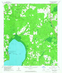
1966 Map of Orange Heights
USGS Topo · Published 1967About this map
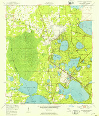
Newnans Lake dominates the southwestern quadrant of this Alachua County landscape, where the shoreline is defined by the Sunland Center State Park and the Newnans Lake Homesites. The interior terrain is a mosaic of hydrologic systems including Gum Root Swamp and Saluda Swamp, which feed into Hatchet Creek and Lochloosa Creek. The Arredondo Grant Boundary runs through the center of the sheet, reflecting the area's complex land-tenure history from the colonial era. Transportation is anchored by the Seaboard Air Line railroad, which passes through the village of Orange Heights in the northeast. Further south, the rural settlement of Windsor serves as a local hub near Providence Ch, while the northern reaches are preserved within the Austin Cary Memorial Forest.
Find a feature on this map
22 named features on this map. Tap any name to fly to it.
Don’t see what you’re looking for? This feature index may not catch every label — zoom into the map to look around manually.
Map Details
Editions of this 1966 Orange Heights Map
4 editions found
Other maps of this area

1890 · Arredondo
USGS Topo · 1:62,500

1892 · Arredondo
USGS Topo · 1:62,500

1894 · Arredondo
USGS Topo · 1:62,500

1938 · Hawthorn
USGS Topo · 1:48,000

1941 · Starke
USGS Topo · 1:62,500

1943 · Hawthorn
USGS Topo · 1:62,500

1948 · Starke
USGS Topo · 1:50,000

1949 · Waldo
USGS Topo · 1:24,000
1949 · Keystone Heights
USGS Topo · 1:24,000

1949 · Starke
USGS Topo · 1:62,500