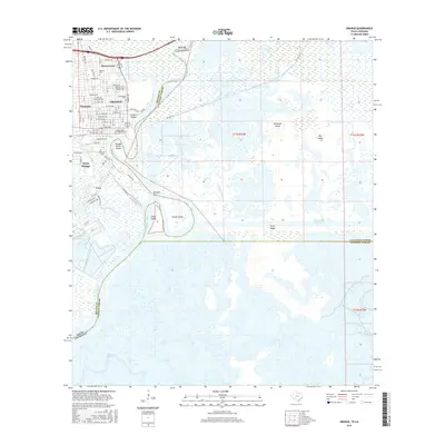
2016 Map of Orange
USGS Topo · Published 2016About this map
Orange sits at the confluence of deep-water navigation and low-lying wetlands where the Sabine River forms the state line between Texas and Louisiana. The city's residential and industrial grid is bordered by the winding Adams Bayou and The Cypress Bayou, illustrating a landscape heavily influenced by maritime commerce. The presence of Lamar State College-Orange and several historic burial sites, such as Hebrew Cem and Hollywood Cem, reflect the community's established social foundations. East of the city, the terrain transitions into a complex network of marshes and water bodies including Phoenix Lake and Mud Lake. This area is defined by significant civil engineering, most notably the Intracoastal Waterway and various cuts like Berwick Cut, which facilitate transit through the delta environments of Pavell Island and Orange Harbor Island.
Find a feature on this map
71 named features on this map. Tap any name to fly to it.
Don’t see what you’re looking for? This feature index may not catch every label — zoom into the map to look around manually.
Map Details
Editions of this 2016 Orange Map
This is the sole edition of this map. No revisions or reprints were ever made.
Other maps of this area

1926 · Mauriceville
USGS Topo · 1:24,000

1932 · Orange
USGS Topo · 1:62,500

1932 · Port Arthur NE
USGS Topo · 1:31,680

1934 · Greens Bayou
USGS Topo · 1:24,000

1934 · Five Lakes
USGS Topo · 1:24,000

1935 · Five Lakes
USGS Topo · 1:31,680

1935 · Greens Bayou
USGS Topo · 1:31,680

1943 · West of Greens Bayou
USGS Topo · 1:24,000

1943 · Orangefield
USGS Topo · 1:24,000

1943 · Mauriceville
USGS Topo · 1:24,000