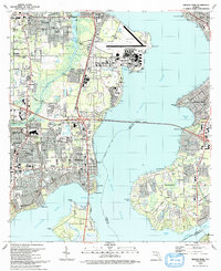
1993 Map of Orange Park
USGS Topo · Published 1993About this map
The St Johns River dominates this early 1990s landscape, serving as a wide natural divide between the residential peninsula of Mandarin and the industrial and military hubs of Orange Park and the Jacksonville Naval Air Station. The air station's extensive infrastructure, including John Towers Field and its long seawall, anchors the northern shore, while the Buckman Bridge provides a critical link across the water.
Find a feature on this map
92 named features on this map. Tap any name to fly to it.
Don’t see what you’re looking for? This feature index may not catch every label — zoom into the map to look around manually.
Map Details
Editions of this 1993 Orange Park Map
2 editions found
Other maps of this area

1917 · Orange Park
USGS Topo · 1:62,500

1917 · Cambon
USGS Topo · 1:62,500

1918 · Middleburg
USGS Topo · 1:62,500

1918 · Cambon
USGS Topo · 1:62,500

1918 · Jacksonville
USGS Topo · 1:62,500

1918 · Orange Park
USGS Topo · 1:62,500

1941 · Middleburg
USGS Topo · 1:62,500

1948 · Jacksonville
USGS Topo · 1:250,000

1949 · Middleburg
USGS Topo · 1:24,000

1949 · Jacksonville Heights
USGS Topo · 1:24,000