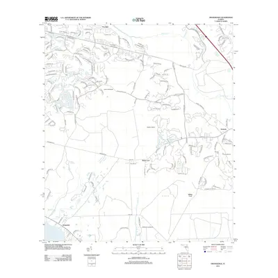
2012 Map of Orangedale
USGS Topo · Published 2012About this map
The Saint Johns River defines the southwestern edge of this northern Florida landscape, where the tidal marsh and inland creek systems meet expanding residential development. This 2012 survey illustrates the transition from traditional riverfront settlements like Orangedale to the growing suburban networks extending from Pine Bluff. Historical crossing points remain noted along the waterways, including Blacks Ford and Whites Ford on the upper reaches of Trout Cr, while the interior terrain is marked by distinctive features such as Fever Hammock and Gopher Island. In the eastern portion of the quadrangle, the community of Sampson is anchored by the Sampson Cem, providing a focal point for genealogical research. The map also traces the drainage patterns of numerous branches, including Molasses Br and Bowen Br, which carve through the low-lying terrain toward the Durbin Cr basin.
Find a feature on this map
142 named features on this map. Tap any name to fly to it.
Don’t see what you’re looking for? This feature index may not catch every label — zoom into the map to look around manually.
Map Details
Editions of this 2012 Orangedale Map
This is the sole edition of this map. No revisions or reprints were ever made.
Other maps of this area

1917 · Orange Park
USGS Topo · 1:62,500

1918 · Orange Park
USGS Topo · 1:62,500

1918 · Palm Valley
USGS Topo · 1:62,500

1937 · Bakersville
USGS Topo · 1:24,000

1943 · St. Augustine
USGS Topo · 1:62,500

1947 · Bostwick
USGS Topo · 1:50,000

1948 · Jacksonville
USGS Topo · 1:250,000

1949 · Green Cove Springs
USGS Topo · 1:24,000
1949 · Picolata
USGS Topo · 1:24,000
1949 · Bostwick
USGS Topo · 1:62,500