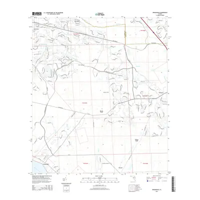
2015 Map of Orangedale
USGS Topo · Published 2015About this map
The Saint Johns River defines the southwestern edge of this landscape, where the settlement of Orangedale sits along its banks. Moving inland, the terrain is defined by a network of drainage systems including Durbin Creek, Cunningham Cr, and Trout Creek. These waterways frame distinctive topographical features like Fever Hammock and Gopher Island. The map illustrates the suburban expansion of communities such as Fruit Cove and Pine Bluff in the north, contrasted with more traditional crossings and landings further south.
Find a feature on this map
56 named features on this map. Tap any name to fly to it.
Don’t see what you’re looking for? This feature index may not catch every label — zoom into the map to look around manually.
Map Details
Editions of this 2015 Orangedale Map
This is the sole edition of this map. No revisions or reprints were ever made.
Other maps of this area

1917 · Orange Park
USGS Topo · 1:62,500

1918 · Orange Park
USGS Topo · 1:62,500

1918 · Palm Valley
USGS Topo · 1:62,500

1937 · Bakersville
USGS Topo · 1:24,000

1943 · St. Augustine
USGS Topo · 1:62,500

1947 · Bostwick
USGS Topo · 1:50,000

1948 · Jacksonville
USGS Topo · 1:250,000

1949 · Green Cove Springs
USGS Topo · 1:24,000
1949 · Picolata
USGS Topo · 1:24,000
1949 · Bostwick
USGS Topo · 1:62,500