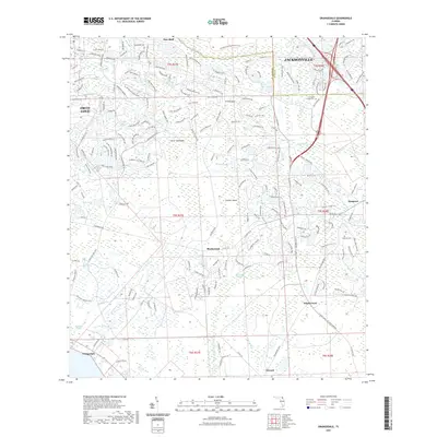
2021 Map of Orangedale
USGS Topo · Published 2021About this map
Fruit Cove and the southern outskirts of Jacksonville define this portion of the Florida landscape, where residential development increasingly meets the wetland systems of the St. Johns River drainage. Low-lying terrain is marked by significant hydrological features like the Julington Durbin Preserve Trl and the expansive Big Island Swamp. Historically, the map documents several river-related settlements and crossing points such as Whites Ford, Blacks Ford, and Orangedale, reflecting an era when these locations served as vital transit nodes. The prevalence of hammocks and islands, such as Fever Hammock and Gopher Island, reveals how slightly elevated ground once dictated the placement of early homes and roads amidst the surrounding marshlands. Family history is anchored here at the Julington Creek Cem and Sampson Cem, providing essential points of reference for genealogical research in this evolving coastal plain.
Find a feature on this map
201 named features on this map. Tap any name to fly to it.
Don’t see what you’re looking for? This feature index may not catch every label — zoom into the map to look around manually.
Map Details
Editions of this 2021 Orangedale Map
This is the sole edition of this map. No revisions or reprints were ever made.
Other maps of this area

1917 · Orange Park
USGS Topo · 1:62,500

1918 · Orange Park
USGS Topo · 1:62,500

1918 · Palm Valley
USGS Topo · 1:62,500

1937 · Bakersville
USGS Topo · 1:24,000

1943 · St. Augustine
USGS Topo · 1:62,500

1947 · Bostwick
USGS Topo · 1:50,000

1948 · Jacksonville
USGS Topo · 1:250,000

1949 · Green Cove Springs
USGS Topo · 1:24,000
1949 · Picolata
USGS Topo · 1:24,000
1949 · Bostwick
USGS Topo · 1:62,500