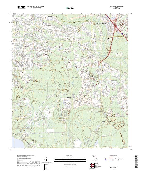
2024 Map of Orangedale
USGS Topo · Published 2024About this map
Fruit Cove and Orangedale anchor this detailed study of the northern St. Johns County corridor. The landscape is defined by the winding course of Durbin Creek and the intricate wetlands of Big Island Swamp and Flat Swamp. Historical river crossings and lowlands are noted at Whites Ford and Blacks Ford, while the namesake Orangedale sits at the southern edge of the sheet. Modern suburban development, indicated by a dense network of residential loops such as Larkspur Loop and Sparrow Branch Cir, pushes against established natural features like Gopher Island and Fever Hammock. Genealogists will find interest in the documented locations of Julington Creek Cem and Sampson Cem, which mark the community's early settlement roots amidst the expanding footprint of modern Jacksonville.
Find a feature on this map
59 named features on this map. Tap any name to fly to it.
Don’t see what you’re looking for? This feature index may not catch every label — zoom into the map to look around manually.
Map Details
Editions of this 2024 Orangedale Map
This is the sole edition of this map. No revisions or reprints were ever made.
Other maps of this area

1917 · Orange Park
USGS Topo · 1:62,500

1918 · Orange Park
USGS Topo · 1:62,500

1918 · Palm Valley
USGS Topo · 1:62,500

1937 · Bakersville
USGS Topo · 1:24,000

1943 · St. Augustine
USGS Topo · 1:62,500

1947 · Bostwick
USGS Topo · 1:50,000

1948 · Jacksonville
USGS Topo · 1:250,000

1949 · Green Cove Springs
USGS Topo · 1:24,000
1949 · Picolata
USGS Topo · 1:24,000
1949 · Bostwick
USGS Topo · 1:62,500