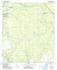
1993 Map of Orangedale
USGS Topo · Published 1993About this map
St Johns River frontage defines the western boundary of this coastal Florida landscape, where the tidal wetlands of Cunningham Creek and Julington Creek meet the growing residential suburbs south of the Duval county line. The map captures a mix of established community institutions, such as Fruit Cove Ch and Julington Creek Sch, alongside large tracts of marsh and swamp including Cartwheel Bay and Fish Swamp. Historic river access points and crossings are documented at Whites Ford and Blacks Ford, while the inland settlement of Sampson remains anchored by the Sampson Cem. The presence of the Trinity Rehabilitation Camp and the remains noted as Ruins near the northern boundary suggest a landscape in transition, where old land use patterns persist amidst modern road networks like Bombing Range Road and Greenbriar Road.
Find a feature on this map
45 named features on this map. Tap any name to fly to it.
Don’t see what you’re looking for? This feature index may not catch every label — zoom into the map to look around manually.
Map Details
Editions of this 1993 Orangedale Map
This is the sole edition of this map. No revisions or reprints were ever made.
Other maps of this area

1917 · Orange Park
USGS Topo · 1:62,500

1918 · Orange Park
USGS Topo · 1:62,500

1918 · Palm Valley
USGS Topo · 1:62,500

1937 · Bakersville
USGS Topo · 1:24,000

1943 · St. Augustine
USGS Topo · 1:62,500

1947 · Bostwick
USGS Topo · 1:50,000

1948 · Jacksonville
USGS Topo · 1:250,000

1949 · Green Cove Springs
USGS Topo · 1:24,000
1949 · Picolata
USGS Topo · 1:24,000
1949 · Bostwick
USGS Topo · 1:62,500