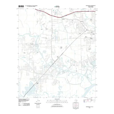
2010 Map of Orangefield
USGS Topo · Published 2010About this map
Cow Bayou and Coon Bayou wind through this coastal Texas landscape, defining the interconnected settlements between the Sabine River and the local marshes. In the south, the established grid of Bridge City meets the waterfront, while the northern reaches show the smaller communities of Tulane, Bancroft, and Pinehurst following the expansion of the regional road network. The map reveals a dense distribution of family and memorial grounds, including the Dorman Cemetery, Winfree Cemetery, and Granger Cemetery, which serve as vital landmarks for those tracing local lineage. Aviation and industry are represented by the Orange County Airport and the Chesson Airport, punctuating the transition from the oil-rich heritage of Orangefield to the modern residential corridors of West Orange.
Find a feature on this map
62 named features on this map. Tap any name to fly to it.
Don’t see what you’re looking for? This feature index may not catch every label — zoom into the map to look around manually.
Map Details
Editions of this 2010 Orangefield Map
This is the sole edition of this map. No revisions or reprints were ever made.
Other maps of this area

1926 · Terry
USGS Topo · 1:24,000

1926 · Texla
USGS Topo · 1:24,000

1926 · Mauriceville
USGS Topo · 1:24,000

1932 · Orange
USGS Topo · 1:62,500

1932 · Port Arthur NE
USGS Topo · 1:31,680

1934 · Greens Bayou
USGS Topo · 1:24,000

1935 · Greens Bayou
USGS Topo · 1:31,680

1943 · West of Greens Bayou
USGS Topo · 1:24,000

1943 · Orangefield
USGS Topo · 1:24,000

1943 · Mauriceville
USGS Topo · 1:24,000