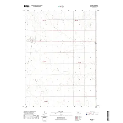
2017 Map of Orchard
USGS Topo · Published 2017About this map
Orchard and Royal anchor this agricultural landscape in northeastern Nebraska, where the section-line road grid organizes the high plains of Antelope County. The town of Orchard is particularly well-documented, showing a detailed street layout including Windom St, Harrison St, and Clara St, which supports local residential and commercial activity. For genealogists and local historians, the presence of Orchard Cem and Saint Peters Cem provides important points of reference for family research in the area.
Find a feature on this map
42 named features on this map. Tap any name to fly to it.
Don’t see what you’re looking for? This feature index may not catch every label — zoom into the map to look around manually.
Map Details
Editions of this 2017 Orchard Map
This is the sole edition of this map. No revisions or reprints were ever made.
Other maps of this area

1955 · O'Neill
USGS Topo · 1:250,000

1959 · O'Neill
USGS Topo · 1:250,000

1963 · Orchard NE
USGS Topo · 1:24,000

1963 · Neligh
USGS Topo · 1:24,000

1963 · Venus
USGS Topo · 1:24,000

1963 · Royal
USGS Topo · 1:24,000

1963 · Orchard
USGS Topo · 1:24,000

1963 · Ewing
USGS Topo · 1:24,000

1963 · Deloit NE
USGS Topo · 1:24,000
1963 · Clearwater
USGS Topo · 1:24,000