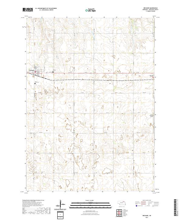
2021 Map of Orchard
USGS Topo · Published 2021About this map
Orchard and the small community of Royal anchor this section of Antelope County, where the landscape is defined by a grid of agricultural section lines and rural roadways. In the northwest, the town of Orchard is documented in detail, including its local street names like Harrison St and Clara St. For those researching family history, both Orchard Hill Cem and Saint Peters Cem are clearly marked on the outskirts of town. The terrain north of the settlements is shaped by the presence of Hathaway Slough and the winding course of Hay Cr. This modern survey also identifies Dennys Playground Airport to the east, reflecting the continued importance of local aviation in this rural Nebraska region. The map provides a clear picture of the township and range divisions, showing how the land is partitioned across t28n r8w and surrounding areas.
Find a feature on this map
37 named features on this map. Tap any name to fly to it.
Don’t see what you’re looking for? This feature index may not catch every label — zoom into the map to look around manually.
Map Details
Editions of this 2021 Orchard Map
This is the sole edition of this map. No revisions or reprints were ever made.
Other maps of this area

1955 · O'Neill
USGS Topo · 1:250,000

1959 · O'Neill
USGS Topo · 1:250,000

1963 · Orchard NE
USGS Topo · 1:24,000

1963 · Neligh
USGS Topo · 1:24,000

1963 · Venus
USGS Topo · 1:24,000

1963 · Royal
USGS Topo · 1:24,000

1963 · Orchard
USGS Topo · 1:24,000

1963 · Ewing
USGS Topo · 1:24,000

1963 · Deloit NE
USGS Topo · 1:24,000
1963 · Clearwater
USGS Topo · 1:24,000