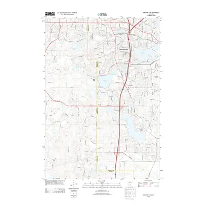
2013 Map of Orchard Lake
USGS Topo · Published 2013About this map
Buck Hill stands as a prominent landmark in this suburban landscape south of the Twin Cities, where the Buck Hill Ski Area and Orchard Gardens Golf Course define the local recreational character. The area is defined by its numerous glacial lakes, including Orchard Lake, Marion Lake, and Crystal Lake, which are surrounded by a dense network of residential streets and arterial roads like Co Hwy 42 and Egan Dr. This 2013 survey illustrates the high level of development reached by the early 21st century, particularly in established settlements like Orchard Garden, Argonne, and Deer Park. While modern infrastructure dominates, the map also identifies historical community spaces such as Antlers Park and several large-scale green spaces like the Legends Golf Course, showing how the natural drainage of the Credit River has been integrated into the modern built environment.
Find a feature on this map
65 named features on this map. Tap any name to fly to it.
Don’t see what you’re looking for? This feature index may not catch every label — zoom into the map to look around manually.
Map Details
Editions of this 2013 Orchard Lake Map
This is the sole edition of this map. No revisions or reprints were ever made.
Other maps of this area

1896 · Minneapolis
USGS Topo · 1:62,500

1896 · St. Paul
USGS Topo · 1:62,500

1901 · Minneapolis
USGS Topo · 1:62,500

1951 · St. Paul SW
USGS Topo · 1:24,000

1951 · St. Paul
USGS Topo · 1:62,500

1953 · Saint Paul
USGS Topo · 1:250,000

1954 · Bloomington
USGS Topo · 1:24,000

1954 · Eden Prairie
USGS Topo · 1:24,000

1954 · Minneapolis
USGS Topo · 1:62,500

1957 · Farmington
USGS Topo · 1:62,500