
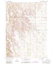
1963 Map of Orchard NE
USGS Topo · Published 1964About this map
The rolling plains along the Knox and Antelope County line are documented in this early 1960s survey, showing a landscape defined by small-scale agriculture and dispersed rural institutions. The drainage of Merriman Creek and the meandering Verdigre Creek carve through the townships of Logan, Miller, and Verdigris, providing the primary geographical anchors for this section of the Missouri River Basin.
Find a feature on this map
15 named features on this map. Tap any name to fly to it.
Don’t see what you’re looking for? This feature index may not catch every label — zoom into the map to look around manually.
Map Details
Editions of this 1963 Orchard NE Map
2 editions found
Other maps of this area

1954 · Walnut
USGS Topo · 1:24,000

1954 · Verdigre
USGS Topo · 1:24,000

1955 · Sioux City
USGS Topo · 1:250,000

1955 · O'Neill
USGS Topo · 1:250,000

1958 · Sioux City
USGS Topo · 1:250,000

1959 · O'Neill
USGS Topo · 1:250,000

1959 · Sioux City
USGS Topo · 1:250,000

1963 · Brunswick
USGS Topo · 1:24,000

1963 · Royal
USGS Topo · 1:24,000

1963 · Orchard
USGS Topo · 1:24,000