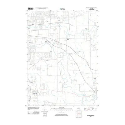
2010 Map of Orchard Park
USGS Topo · Published 2010About this map
Buffalo Creek and Cazenovia Creek wind through this part of Erie County, defining the settlement patterns of towns like Gardenville, Blossom, and Orchard Park. The map shows a landscape transitioning from the agricultural roots of Schrader Farm and Peppermint Farms to the residential expansion seen near East Seneca and Elma Center. The northern portion is marked by the presence of Buffalo Airfield and the historic corridors of Seneca St and Transit Rd, which have long served as primary arteries for the region. Local history is preserved in sites like Saint Johns Cemetery and Union Cemetery, while the southeast corner highlights the established community of East Aurora. This survey offers a detailed look at the suburban growth and infrastructure of the Buffalo outskirts, including specialized landmarks like Angle Acres Greenhouses and the rail-linked Spring Brook Station.
Find a feature on this map
72 named features on this map. Tap any name to fly to it.
Don’t see what you’re looking for? This feature index may not catch every label — zoom into the map to look around manually.
Map Details
Editions of this 2010 Orchard Park Map
This is the sole edition of this map. No revisions or reprints were ever made.
Other maps of this area

1894 · Buffalo
USGS Topo · 1:62,500

1901 · Buffalo
USGS Topo · 1:62,500

1905 · Depew
USGS Topo · 1:62,500

1905 · Eden
USGS Topo · 1:62,500

1907 · Eden
USGS Topo · 1:62,500

1925 · Springville
USGS Topo · 1:62,500

1944 · Eden
USGS Topo · 1:62,500

1944 · Hamburg
USGS Topo · 1:31,680

1948 · Hamburg
USGS Topo · 1:24,000

1948 · Depew
USGS Topo · 1:62,500