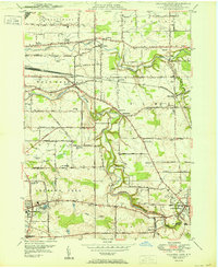
1950 Map of Orchard Park
USGS Topo · Published 1950About this map
Buffalo Creek and Cazenovia Creek carve through the landscape south of Buffalo, defining the settlement patterns of Erie County during the post-war era. Small hamlets like Blossom and Spring Brook appear alongside larger centers like Orchard Park and East Aurora. The presence of the Pennsylvania RR and several local airfields, including Buffalo Air Park, Proner Airport, and Orchard Park Airport, indicates a region in transition from rural agriculture to a more connected suburban and industrial corridor.
Find a feature on this map
55 named features on this map. Tap any name to fly to it.
Don’t see what you’re looking for? This feature index may not catch every label — zoom into the map to look around manually.
Map Details
Editions of this 1950 Orchard Park Map
This is the sole edition of this map. No revisions or reprints were ever made.
Other maps of this area

1894 · Buffalo
USGS Topo · 1:62,500

1901 · Buffalo
USGS Topo · 1:62,500

1905 · Depew
USGS Topo · 1:62,500

1905 · Eden
USGS Topo · 1:62,500

1907 · Eden
USGS Topo · 1:62,500

1925 · Springville
USGS Topo · 1:62,500

1944 · Eden
USGS Topo · 1:62,500

1944 · Hamburg
USGS Topo · 1:31,680

1948 · Hamburg
USGS Topo · 1:24,000

1948 · Depew
USGS Topo · 1:62,500