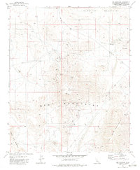
1982 Map of Ord Mountain
USGS Topo · Published 1982About this map
Ord Mountains dominate this high desert landscape within San Bernardino County, where a network of primitive roads and four-wheel-drive trails connects isolated mining claims and water sources. The map reveals an environment defined by resource extraction and survival, centered on the Maumee Mine and several unnamed mines scattered across the slopes of East Ord Mountain. Reliable water sources were clearly vital for the prospectors and ranchers who worked this area, evidenced by the presence of Aztec Spring, Sweetwater Spring, and Willow Spring, alongside improvements like Wills Well and a Corral. To the west, the basin of Tyler Valley descends toward Ericksen Dry Lake, while the northeastern corner transitions into the Newberry Mountains and Rodman Mountains. Modern infrastructure is represented by a Radio Facility perched on a high ridge, highlighting the area's role in regional communication networks during the early 1980s.
Find a feature on this map
20 named features on this map. Tap any name to fly to it.
Don’t see what you’re looking for? This feature index may not catch every label — zoom into the map to look around manually.
Map Details
Editions of this 1982 Ord Mountain Map
3 editions found
Other maps of this area

1953 · San Bernardino
USGS Topo · 1:250,000

1955 · Newberry
USGS Topo · 1:62,500

1955 · Ord Mountains
USGS Topo · 1:62,500

1955 · Rodman Mountains
USGS Topo · 1:62,500

1956 · San Bernardino
USGS Topo · 1:250,000

1956 · Daggett
USGS Topo · 1:62,500

1957 · San Bernardino
USGS Topo · 1:250,000

1958 · San Bernardino
USGS Topo · 1:250,000

1959 · San Bernardino
USGS Topo · 1:250,000

1966 · San Bernardino
USGS Topo · 1:250,000