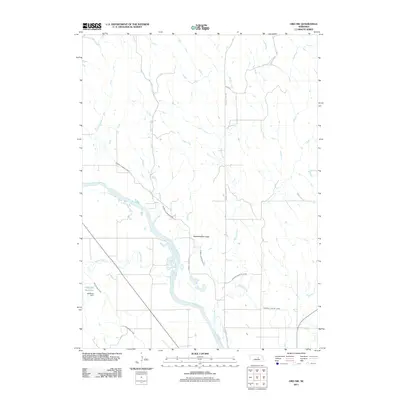
2011 Map of Ord NW
USGS Topo · Published 2011About this map
North Loup River dominates this Garfield County landscape, meandering through a network of vital irrigation infrastructure that defines local agricultural life. The intricate routing of the Burwell Sumter Canal and the Taylor Ord Canal illustrates the managed water systems necessary for Nebraska prairie farming. Water management is further anchored by the Oldfather Dam, which creates the Oldfather Reservoir in the southwestern portion of the map. Several local watercourses, including Gravel Creek, Haskell Creek, and Turtle Creek, feed into the river system, while local transit is represented by rural corridors like Gravel Creek Rd and Haskell Creek Rd. This map captures the intersection of natural hydrology and man-made engineering in a dedicated farming region.
Find a feature on this map
10 named features on this map. Tap any name to fly to it.
Don’t see what you’re looking for? This feature index may not catch every label — zoom into the map to look around manually.
Map Details
Editions of this 2011 Ord NW Map
This is the sole edition of this map. No revisions or reprints were ever made.
Other maps of this area

1952 · Elyria
USGS Topo · 1:24,000

1952 · Burwell SE
USGS Topo · 1:24,000

1952 · Comstock SE
USGS Topo · 1:24,000

1954 · Ord SE
USGS Topo · 1:24,000

1954 · Ord
USGS Topo · 1:24,000

1954 · Gables SE
USGS Topo · 1:24,000

1954 · Gables SW
USGS Topo · 1:24,000

1954 · Ord NE
USGS Topo · 1:24,000

1954 · Ord NW
USGS Topo · 1:24,000

1955 · Broken Bow
USGS Topo · 1:250,000