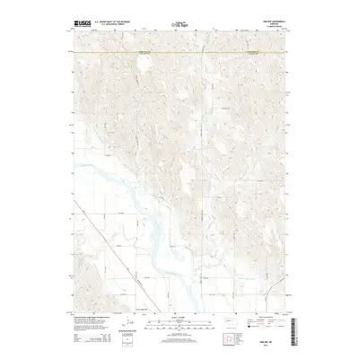
2014 Map of Ord NW
USGS Topo · Published 2014About this map
Evelyn Sharp Field anchors the southern portion of this landscape, reflecting the aviation history and connectivity of this rural corridor along the North Loup River. The area is defined by an intricate network of water management features, including the Burwell-Sumter Canal, Taylor-Ord Canal, and Oldfather Reservoir, which illustrate the intensive agricultural development of the region. These irrigation works follow the natural contours of the river valley, intersecting with local tributaries such as Turtle Cr and Haskell Cr. Crossing the county line between Garfield Co and Valley Co, the survey reveals a transition from the broad, braided riverbed to the more elevated terrain marked by Gravel Cr. The road system, comprising routes like Mortensen Dr and Ne-11, provides a structured grid for accessing these vital water resources and the surrounding farmland.
Find a feature on this map
27 named features on this map. Tap any name to fly to it.
Don’t see what you’re looking for? This feature index may not catch every label — zoom into the map to look around manually.
Map Details
Editions of this 2014 Ord NW Map
This is the sole edition of this map. No revisions or reprints were ever made.
Other maps of this area

1952 · Elyria
USGS Topo · 1:24,000

1952 · Burwell SE
USGS Topo · 1:24,000

1952 · Comstock SE
USGS Topo · 1:24,000

1954 · Ord SE
USGS Topo · 1:24,000

1954 · Ord
USGS Topo · 1:24,000

1954 · Gables SE
USGS Topo · 1:24,000

1954 · Gables SW
USGS Topo · 1:24,000

1954 · Ord NE
USGS Topo · 1:24,000

1954 · Ord NW
USGS Topo · 1:24,000

1955 · Broken Bow
USGS Topo · 1:250,000