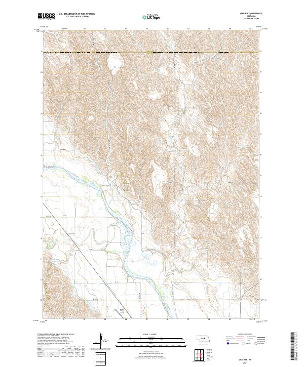
2021 Map of Ord NW
USGS Topo · Published 2021About this map
Evelyn Sharp Field serves as a prominent landmark in this section of the Loup River valley, situated just north of the county line between Garfield Co and Valley Co. The landscape is defined by the braided path of the North Loup River, which is flanked by an intricate irrigation system including the Burwell-Sumter Canal and the Taylor-Ord Canal. These waterways underscore the region's agricultural foundations, carving through the terrain alongside several smaller tributaries like Haskell Cr, Turtle Cr, and Gravel Cr. To the west, the Oldfather Reservoir provides a concentrated water feature amidst the loess hills, while the North Loup River Trl follows the river's course, offering a contemporary layer of transit over this traditional Nebraska farming landscape.
Find a feature on this map
31 named features on this map. Tap any name to fly to it.
Don’t see what you’re looking for? This feature index may not catch every label — zoom into the map to look around manually.
Map Details
Editions of this 2021 Ord NW Map
This is the sole edition of this map. No revisions or reprints were ever made.
Other maps of this area

1952 · Elyria
USGS Topo · 1:24,000

1952 · Burwell SE
USGS Topo · 1:24,000

1952 · Comstock SE
USGS Topo · 1:24,000

1954 · Ord SE
USGS Topo · 1:24,000

1954 · Ord
USGS Topo · 1:24,000

1954 · Gables SE
USGS Topo · 1:24,000

1954 · Gables SW
USGS Topo · 1:24,000

1954 · Ord NE
USGS Topo · 1:24,000

1954 · Ord NW
USGS Topo · 1:24,000

1955 · Broken Bow
USGS Topo · 1:250,000