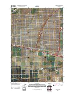
2011 Map of Ordnance
USGS Topo · Published 2011About this map
Ordnance and Munley sit within a landscape of Umatilla County defined by expansive irrigation projects and organized road grids. The northern portion of the region is notably marked by the West Extention Irrigation Canal, while the High Line Canal serves the south, illustrating the area's heavy reliance on engineered water systems for agriculture and habitation. The terrain is relatively uniform, broken only by natural features such as Fourmile Canyon in the southern sector. Local transport is facilitated by a network of rural routes named for local figures and landmarks, including Col Jordon Rd, Madison Sayler Rd, and Staf Ford Hansel Rd. The grid-like patterns of secondary roads and unnamed tracks suggest a highly managed land use at this time, focused on utility and connectivity between the small settlements and the regional transit corridors.
Find a feature on this map
21 named features on this map. Tap any name to fly to it.
Don’t see what you’re looking for? This feature index may not catch every label — zoom into the map to look around manually.
Map Details
Editions of this 2011 Ordnance Map
This is the sole edition of this map. No revisions or reprints were ever made.
Other maps of this area

1906 · Blalock Island
USGS Topo · 1:125,000

1908 · Blalock Island
USGS Topo · 1:125,000

1908 · Umatilla
USGS Topo · 1:125,000

1953 · Pendleton
USGS Topo · 1:250,000

1956 · Pendleton
USGS Topo · 1:250,000

1962 · Ordnance
USGS Topo · 1:24,000

1962 · Paterson
USGS Topo · 1:24,000

1962 · Hermiston
USGS Topo · 1:24,000

1962 · Clarke
USGS Topo · 1:24,000
1962 · Irrigon
USGS Topo · 1:24,000