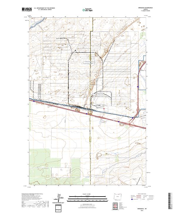
2024 Map of Ordnance
USGS Topo · Published 2024About this map
Joint Base Lewis-Mcchord dominates the central landscape of this Umatilla County quadrangle, where military infrastructure meets the engineered hydrology of the Columbia Basin. The area is defined by a sophisticated network of water management, with the West Extension Irrigation Canal in the northwest, the Westland A Canal to the east, and the High Line Canal cutting through the southern sections. These waterways represent the vital lifelines for agriculture in the high desert, enabling local homesteading indicated by routes like Homestead Rd. In the northeast, the natural topography of Coyote Coulee provides a sharp contrast to the geometric grid of access roads and military boundaries. Transportation is centered on thoroughfares such as Stafford Hansel Rd and Irrigon-Ordnance Rd, while the K2 Airport serves the region's aviation needs near the southern margin.
Find a feature on this map
30 named features on this map. Tap any name to fly to it.
Don’t see what you’re looking for? This feature index may not catch every label — zoom into the map to look around manually.
Map Details
Editions of this 2024 Ordnance Map
This is the sole edition of this map. No revisions or reprints were ever made.
Other maps of this area

1906 · Blalock Island
USGS Topo · 1:125,000

1908 · Blalock Island
USGS Topo · 1:125,000

1908 · Umatilla
USGS Topo · 1:125,000

1953 · Pendleton
USGS Topo · 1:250,000

1956 · Pendleton
USGS Topo · 1:250,000

1962 · Ordnance
USGS Topo · 1:24,000

1962 · Paterson
USGS Topo · 1:24,000

1962 · Hermiston
USGS Topo · 1:24,000

1962 · Clarke
USGS Topo · 1:24,000
1962 · Irrigon
USGS Topo · 1:24,000