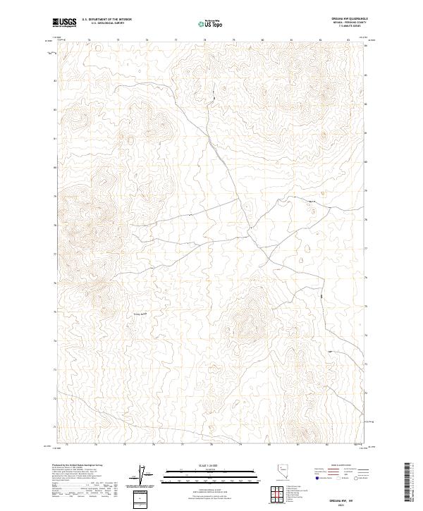
2021 Map of Oreana NW
USGS Topo · Published 2021About this map
The Trinity Range dominates this portion of Pershing County, where the topography of the Great Basin is defined by steep ridges and dry washes. This 2021 edition, produced by the U.S. Geological Survey, provides a modern perspective on a landscape long characterized by its mineral potential and sparse settlement. The map clearly delineates the public land survey system grid, including T30n R31e and T29n R32e, which remains the primary reference for land ownership and mining claims in this arid region.
Find a feature on this map
5 named features on this map. Tap any name to fly to it.
Don’t see what you’re looking for? This feature index may not catch every label — zoom into the map to look around manually.
Map Details
Editions of this 2021 Oreana NW Map
This is the sole edition of this map. No revisions or reprints were ever made.
Other maps of this area

1931 · Lovelock
USGS Topo · 1:250,000

1935 · Lovelock
USGS Topo · 1:250,000

1955 · Lovelock
USGS Topo · 1:250,000

1956 · Oreana
USGS Topo · 1:62,500

1959 · Lovelock
USGS Topo · 1:250,000

1971 · Rye Patch Reservoir South
USGS Topo · 1:24,000

1971 · Poker Brown
USGS Topo · 1:24,000

1981 · Natchez Spring
USGS Topo · 1:24,000
1981 · Poker Brown Gap
USGS Topo · 1:24,000

1981 · Poker Brown Spring
USGS Topo · 1:24,000