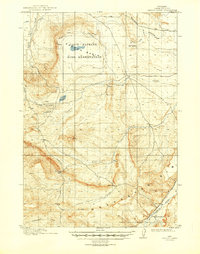
1913 Map of Oregon Basin
USGS Topo · Published 1949About this map
The Oregon Basin Bird Reservation sits at the heart of this Wyoming landscape, surrounding the waters of Loch-Katrine and Mud Springs. Surveyed between 1910 and 1911, the map captures a period of early 20th-century irrigation and resource extraction. The landscape is marked by the presence of the Wiley Canal (Abandoned) and the Burlington Road Canal (Abandoned), which reflect the era's ambitious efforts to move water through this arid basin. Mining activity is evident near Wiley Lake, where the Eagle Mine and Wiley Mine are located.
Find a feature on this map
18 named features on this map. Tap any name to fly to it.
Don’t see what you’re looking for? This feature index may not catch every label — zoom into the map to look around manually.
Map Details
Editions of this 1913 Oregon Basin Map
2 editions found
Other maps of this area

1911 · Meeteetse
USGS Topo · 1:62,500

1911 · Oregon Basin
USGS Topo · 1:62,500

1913 · Oregon Basin
USGS Topo · 1:62,500

1913 · Meeteetse
USGS Topo · 1:62,500

1949 · Cody
USGS Topo · 1:62,500

1951 · Cody
USGS Topo · 1:62,500

1951 · Y U Bench NW
USGS Topo · 1:24,000

1951 · Sheets Flat
USGS Topo · 1:24,000

1951 · Wilson Spring
USGS Topo · 1:24,000

1955 · Cody
USGS Topo · 1:250,000