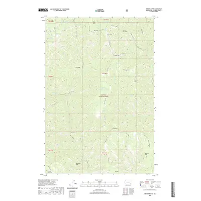
2020 Map of Oregon Butte
USGS Topo · Published 2020About this map
Umatilla National Forest encompasses this high-elevation landscape in Columbia County, dominated by the prominent peak of Oregon Butte. The terrain is defined by a series of radiating ridges including West Butte Ridge, French Ridge, and Yearling Ridge, which divide the deep drainages of Butte Cr and Crooked Cr. Historically, this area has served as a critical water source and transit corridor, evidenced by numerous named springs such as Moolack Spring, Tepee Spring, and Huckleberry Spring. A network of trails, including the Mt Misery Trail and Smooth Ridge Trail, suggests the longstanding use of these ridgelines for movement through the steep country. The geography is punctuated by significant landmarks like Danger Point and the dramatic Box Canyon, reflecting a landscape shaped by the erosive force of the high-country creeks.
Find a feature on this map
59 named features on this map. Tap any name to fly to it.
Don’t see what you’re looking for? This feature index may not catch every label — zoom into the map to look around manually.
Map Details
Editions of this 2020 Oregon Butte Map
This is the sole edition of this map. No revisions or reprints were ever made.
Other maps of this area

1937 · Pomeroy
USGS Topo · 1:96,000

1942 · Pomeroy
USGS Topo · 1:125,000

1955 · Pullman
USGS Topo · 1:250,000

1955 · Grangeville
USGS Topo · 1:250,000

1958 · Pullman
USGS Topo · 1:250,000

1959 · Grangeville
USGS Topo · 1:250,000

1967 · Eden
USGS Topo · 1:24,000

1967 · Elbow Creek
USGS Topo · 1:24,000

1967 · Oregon Butte
USGS Topo · 1:24,000

1967 · Stentz Spring
USGS Topo · 1:24,000