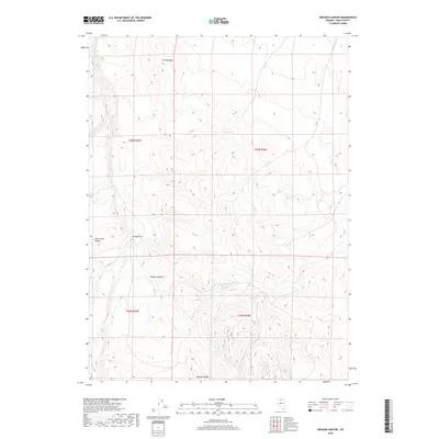
2018 Map of Oregon Canyon
USGS Topo · Published 2018About this map
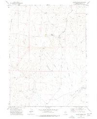
Oregon Canyon and the high elevations of Castle Ridge define this high-desert landscape in Elko County, where the terrain transitions toward the Owyhee Bluffs. This 2018 survey reveals a topography sculpted by seasonal watercourses like Winters Cr and Brush Cr, which feed into the broader Oregon Flat. The importance of water in this arid environment is evident from the naming of specific perennial sources such as Thousand Springs and Castle Spring. Located at the intersection of several townships, the map documents a territory defined more by its natural landmarks and ridgelines, including Pole Creek Ridge, than by human settlement. It serves as a modern record of the hydrology and elevation patterns of the Elko County backcountry, including the drainage basins for Secret Cr, Midas Cr, and Squaw Cr.
Find a feature on this map
16 named features on this map. Tap any name to fly to it.
Don’t see what you’re looking for? This feature index may not catch every label — zoom into the map to look around manually.
Map Details
Editions of this 2018 Oregon Canyon Map
This is the sole edition of this map. No revisions or reprints were ever made.
Other maps of this area

1955 · McDermitt
USGS Topo · 1:250,000

1959 · McDermitt
USGS Topo · 1:250,000
1965 · Jake Creek Mtn
USGS Topo · 1:24,000
1965 · Squaw Valley Ranch
USGS Topo · 1:24,000
1965 · Midas
USGS Topo · 1:24,000
1973 · Snowstorm Mtn
USGS Topo · 1:24,000
1973 · Rodear Flat
USGS Topo · 1:24,000
1973 · Haystack Peak
USGS Topo · 1:24,000
1974 · Burner Hills
USGS Topo · 1:24,000
1977 · Scraper Springs
USGS Topo · 1:24,000