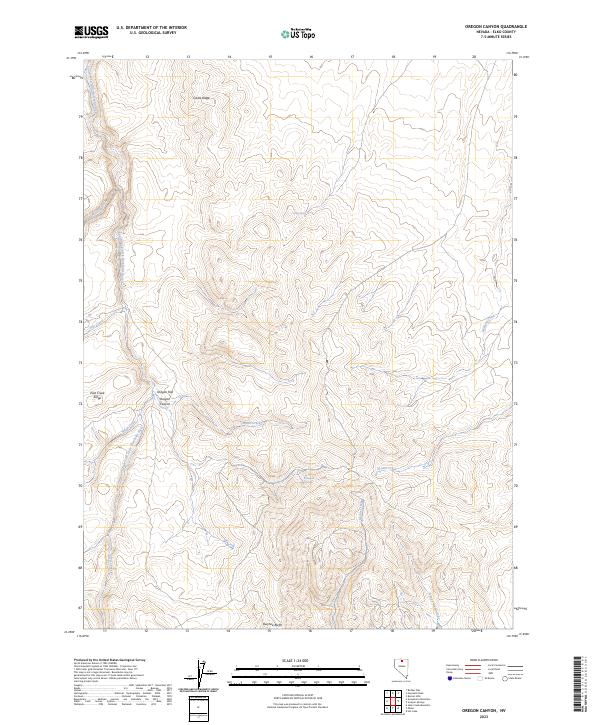
2023 Map of Oregon Canyon
USGS Topo · Published 2023About this map
The South Fork Little Humboldt River carves through this high-desert landscape of Elko County, marking a complex drainage system that defines the local geography. Significant elevation changes are anchored by Castle Ridge to the north and the Owyhee Bluffs along the southern margin. The central portion of the map is dominated by the namesake Oregon Canyon and the adjacent Oregon Flat, which sit between the prominent Pole Creek Ridge and the winding course of the river. This area's hydrology is characterized by numerous seasonal and perennial water sources, including the strategically located Castle Spring and the cluster of Thousand Springs. The map also preserves indigenous naming with Ishape'-Naokwaide, reflecting the deep cultural history of these remote basins. Various tributaries like Brush Creek and Midas Creek further illustrate the intricate watershed that supports this high-altitude rangeland.
Find a feature on this map
21 named features on this map. Tap any name to fly to it.
Don’t see what you’re looking for? This feature index may not catch every label — zoom into the map to look around manually.
Map Details
Editions of this 2023 Oregon Canyon Map
This is the sole edition of this map. No revisions or reprints were ever made.
Other maps of this area

1955 · McDermitt
USGS Topo · 1:250,000

1959 · McDermitt
USGS Topo · 1:250,000
1965 · Jake Creek Mtn
USGS Topo · 1:24,000

1965 · Squaw Valley Ranch
USGS Topo · 1:24,000
1965 · Midas
USGS Topo · 1:24,000

1973 · Snowstorm Mtn
USGS Topo · 1:24,000
1973 · Rodear Flat
USGS Topo · 1:24,000

1973 · Haystack Peak
USGS Topo · 1:24,000

1974 · Burner Hills
USGS Topo · 1:24,000

1977 · Scraper Springs
USGS Topo · 1:24,000