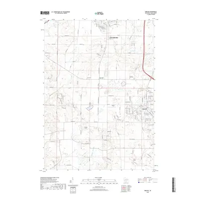
2018 Map of Oregon
USGS Topo · Published 2018About this map
Oregon and Fitchburg anchor this southern Dane County landscape, where the agricultural traditions of Oak Hall meet the encroaching residential growth of the late twenty-first century. The terrain is defined by glacial depressions and water features, including the sprawling Barney Swamp and the isolated Lake Harriet. Significant genealogical resources are documented throughout the township, from the Saint Mary's Catholic Cem to the Storytown Cem near the southern border. The transition from rural to suburban is evident in the network of local roads such as Whalen Rd and S Seminole Hwy, while aviation interests are represented by local strips like Storytown Airfield and Syvrud Airport. Small watercourses, including Murphys Cr and Oregon Br, drain the undulating fields of Fisher Valley, illustrating the persistent connection between the area's natural drainage and its historical land use patterns.
Find a feature on this map
129 named features on this map. Tap any name to fly to it.
Don’t see what you’re looking for? This feature index may not catch every label — zoom into the map to look around manually.
Map Details
Editions of this 2018 Oregon Map
This is the sole edition of this map. No revisions or reprints were ever made.
Other maps of this area

1889 · Evansville
USGS Topo · 1:62,500

1890 · Madison
USGS Topo · 1:62,500

1892 · Madison
USGS Topo · 1:62,500

1894 · Evansville
USGS Topo · 1:62,500

1904 · Madison
USGS Topo · 1:62,500

1906 · Evansville
USGS Topo · 1:62,500

1906 · Madison
USGS Topo · 1:62,500

1907 · Cross Plains
USGS Topo · 1:62,500

1909 · Cross Plains
USGS Topo · 1:62,500

1923 · New Glarus
USGS Topo · 1:62,500