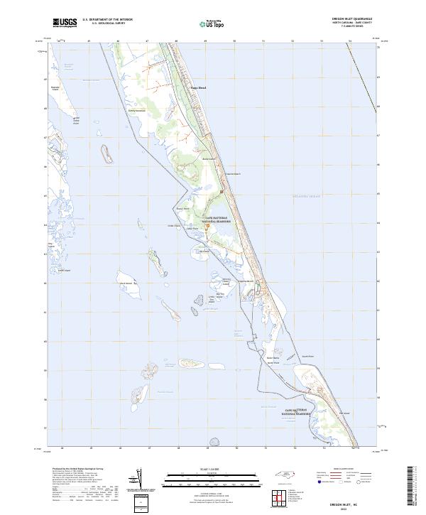
2022 Map of Oregon Inlet
USGS Topo · Published 2022About this map
The shifting sands of the Outer Banks are meticulously documented here, showing the complex interplay of water and land where Roanoke Sound meets Pamlico Sound. This barrier island environment is anchored by Bodie Island and the southern reaches of Nags Head, with the Herbert C. Bonner Bridge providing the vital transportation link across the volatile Oregon Inlet. Much of the territory is dedicated to conservation, split between the Pea Island National Wildlife Refuge and the Cape Hatteras National Seashore.
Find a feature on this map
52 named features on this map. Tap any name to fly to it.
Don’t see what you’re looking for? This feature index may not catch every label — zoom into the map to look around manually.
Map Details
Editions of this 2022 Oregon Inlet Map
This is the sole edition of this map. No revisions or reprints were ever made.
Other maps of this area

1943 · Roanoke Island
USGS Topo · 1:125,000

1953 · Wanchese
USGS Topo · 1:24,000

1953 · Roanoke Island NE
USGS Topo · 1:24,000

1953 · Stumpy Point
USGS Topo · 1:24,000

1953 · Manteo
USGS Topo · 1:24,000

1955 · Wanchese
USGS Topo · 1:250,000

1957 · Manteo
USGS Topo · 1:250,000

1960 · Manteo
USGS Topo · 1:250,000

1985 · Manteo
USGS Topo · 1:100,000
2002 · Stumpy Point
USGS Topo · 1:24,000